How it works
Plug it in. Scan the code.
A SeaTrack One on board reads the instruments your boat already has and sends what they read to your SeaTrack account, as it happens. No new sensors, no rewiring.
Setting up
Three steps, and you’re live.
1. Order a SeaTrack One
Order it with your plan. You buy the box outright, or it’s free on a 12-month Skipper or Fleet plan.
2. Connect it on board
Plug it into your boat’s NMEA 2000 network and power. Then connect it to your boat’s internet through its own setup WiFi: a cable to your router or Starlink, or your marina’s WiFi.
3. Scan the code
Scan the QR code on the box in the SeaTrack app, or type its code in. It joins your account, and your boat comes up live on the chart.
What it reads
Whatever your boat’s network carries.
SeaTrack reads the NMEA 2000 network straight off the backbone. If an instrument is on the network, its readings come through. No guessing from a GPS trail.
- Position, speed and course over ground
- Heading
- Depth
- Wind, true and apparent
- Engines: rpm, temperatures, oil pressure, hours
- Fuel flow and tank levels
- Batteries: voltage, current, temperature
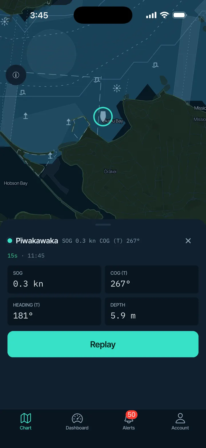
Patchy signal
Built for boats that drop out of range.
Marina WiFi comes and goes, and so does coverage out on the water. SeaTrack is made for that.
It keeps recording on board
Out of range, the SeaTrack One keeps its readings on its own storage. When the connection comes back, it sends the latest first, so the chart is current straight away, then catches up on the rest.
It goes easy on your data
Uploads are compressed, and readings that haven’t changed aren’t sent again. The app shows how much internet each SeaTrack One used today, and the web shows the last 30 days.
You can tell what’s current
Every reading shows how old it is. When a boat stops reporting, its dashboard says so, instead of showing old numbers as if they were live.
Also supported
Already have a PredictWind DataHub?
SeaTrack can run on a PredictWind DataHub too. Talk to us and we’ll tell you whether yours will work.
Good to know
For awareness, not navigation.
SeaTrack shows you where your vessels are and how they’re running. Its charts are built from open data and are not navigation charts.